

Skip to content

How it works/Software

Your whole floor, on one screen.

Four tools, each for a different person: the one who sets the site up, the one who runs the floor, the one who keeps the system healthy, and the one who builds on it. Together they turn every position into something you can act on.

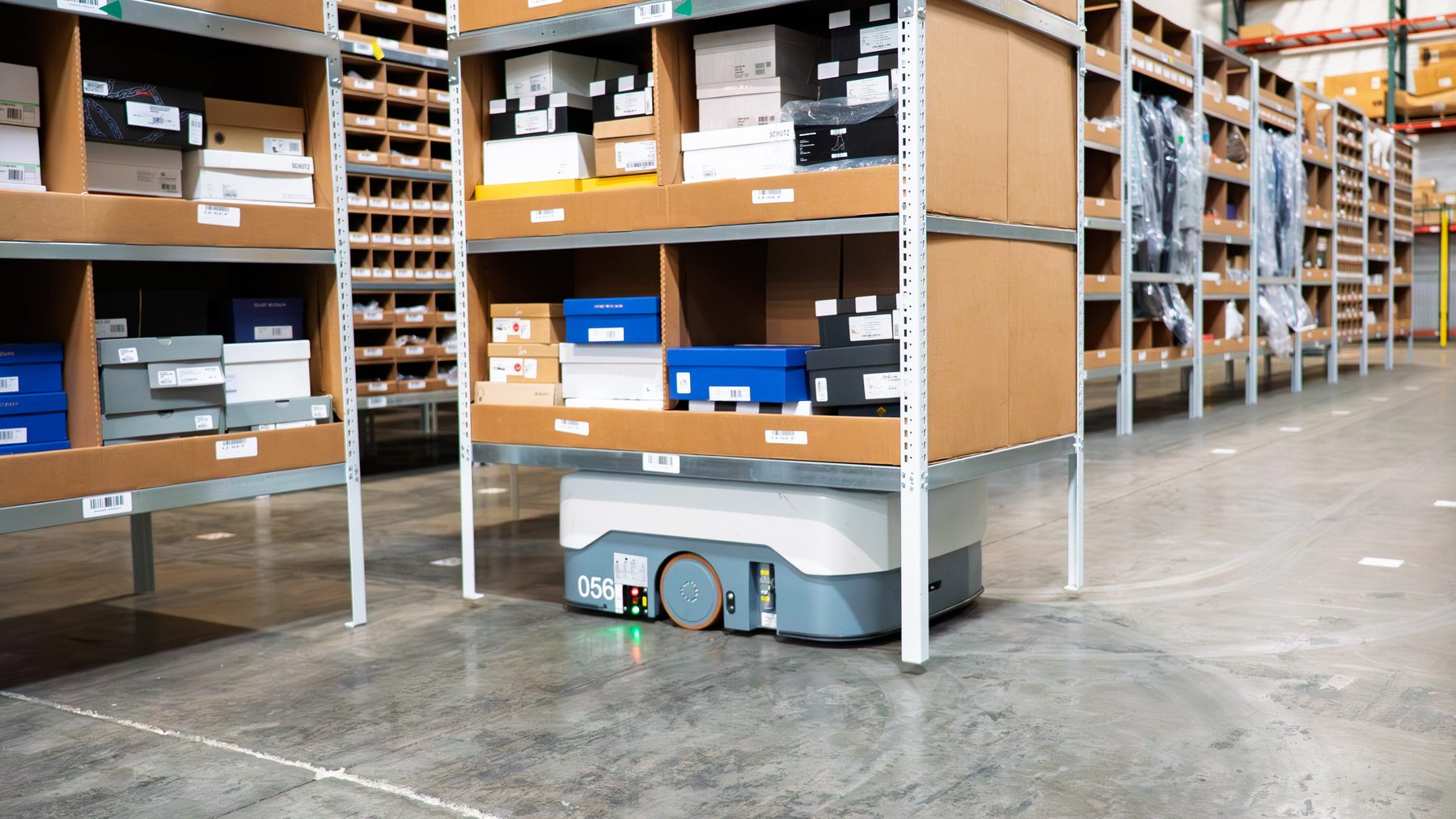
Autonomous mobile robots moving between shelving in a fulfilment warehouse
People, trucks and robots, all moving at once. The software shows you where each one is — and what just happened.

See your moving world

From a live dot on a map to a better decision.

Our RTLS software gives you the tools to configure your system with precision, and the data insights and reports to help you make the most informed decisions about your operational processes and performance. Our open architecture means that location data can flow into the management system you already use.

Define location coverage based on actual floor plans

Manage users, zones, and trackables throughout your facility.

Real-time visualization of your entire environment

See activity, roadblocks, interactions, and near-miss events.

Powerful reporting on what matters

Use analytics, reports, and dashboards for discovering inefficiencies and reviewing forensic data.

Cloud-based or on-premises

Choose your preferred server hosting.

Open API connects with any platform

Our system is built to integrate with third-party systems for data integration and management.

Our RTLS software solutions

Four tools, four jobs.

Start with the person, then the tool. Here’s who uses each one, and what they do with it — in the order you’d use them.

For the person setting up the site

SitePlan

Draw your floor, decide what gets tracked, and tune the system to it.
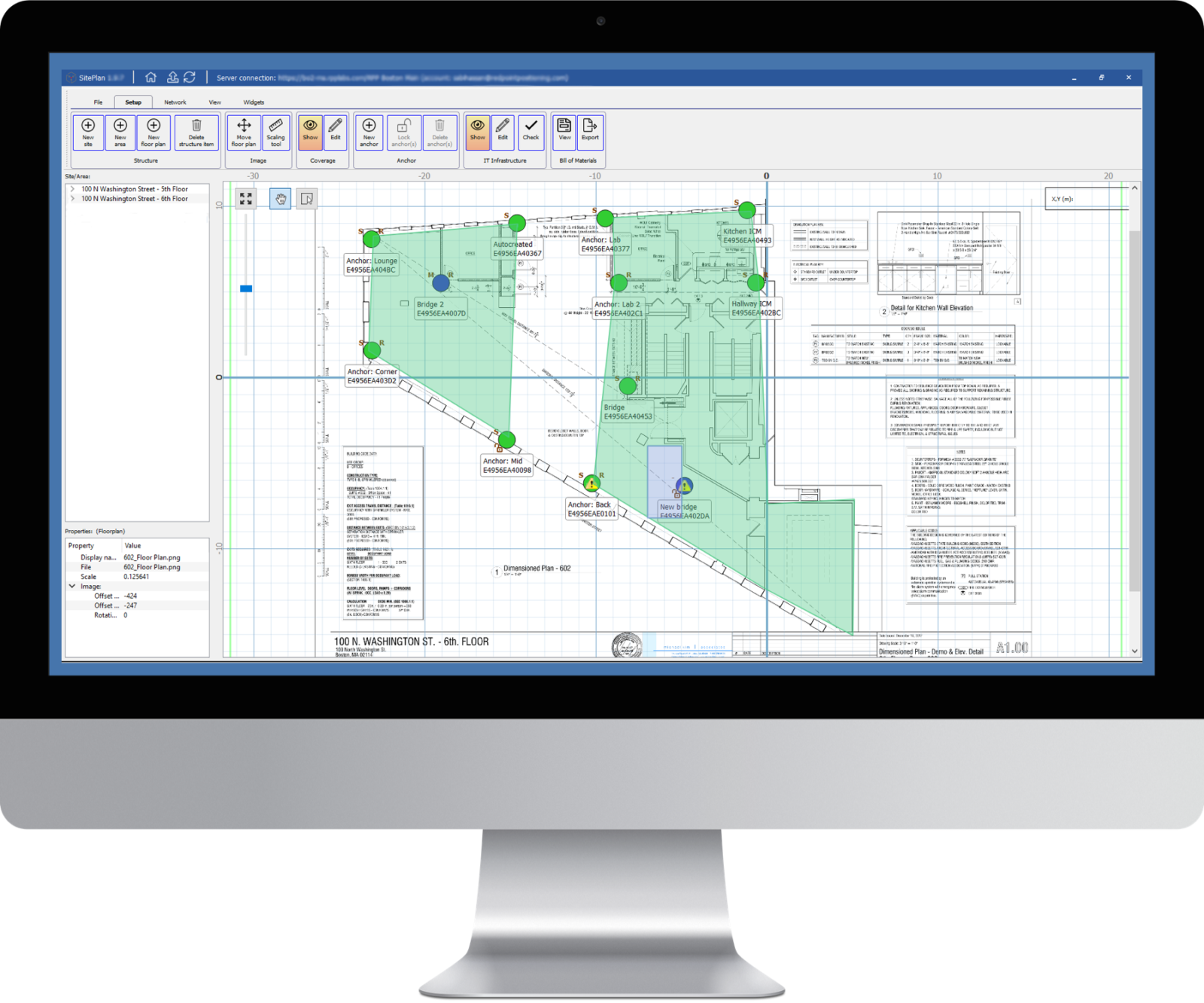
SitePlan: a building floor plan with anchors placed as points and shaded coverage zones
SitePlan: anchors, coverage and zones laid over your real floor plan.

Our RTLS server software, SitePlan, can be hosted in the Cloud or on-premises. Use SitePlan to define your location coverage based on actual floor plans and optimize the system for high precision and low latency performance. Define and manage users, zones, and trackables while managing the network and your hardware devices.

Easy to navigate and flexible when you need to make changes, SitePlan is the planning powerhouse to get your facility connected.
For the people running the floor

SiteWise

Watch the floor live, spot the near-misses, and find out why they happened.

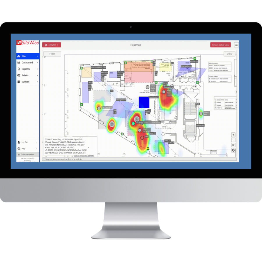
SiteWise: a heatmap of activity over a floor plan, with tagged people and assets labelled
SiteWise: the heatmap shows where the floor gets busy.

Our application RTLS software, SiteWise, empowers you with real-time visualization of your entire facility. View heatmaps and spaghetti diagrams to track paths and visualize activity, roadblocks, interactions, and near-miss events. Manage all location data, alarms, and events in one place, and use data reports and dashboards to discover inefficiencies or analyze incidents.

SiteWise turns live positioning information into actionable safety alerts, site monitoring dashboards, and the analytics to improve your facility’s performance.

For your IT manager

SiteMonitor

Know the system is healthy — and hear about it first if it isn’t.

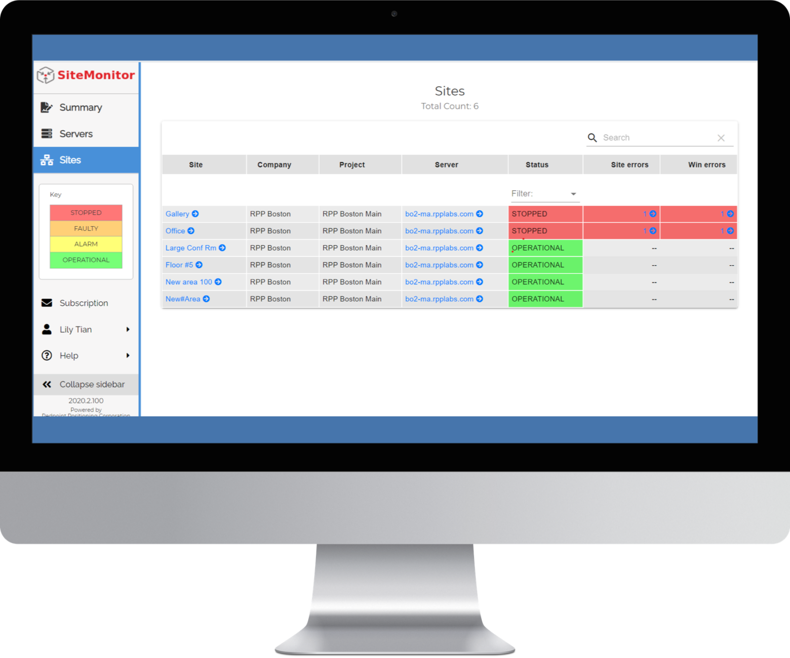
SiteMonitor: a table of sites, some operational and some stopped with errors
SiteMonitor: every site and server, sorted by how urgent it is.

SiteMonitor ensures the system is operating properly at all times and delivers real-time notifications to your IT Manager should an issue occur. The tool monitors both the Wireless Infrastructure Network (WIN) and the server modules.

With convenient, real-time messages, the user receives notifications about either component (server or site) based on severity level. Once the malfunction is addressed, the system will clear the status to notify the system that the issue has been addressed.

For your developers and integrators

Open API

Take the location data anywhere, and make the system work your way.

Our real-time location system is designed to be the most flexible and configurable system available. Integrate with any existing or third-party system to access data from the RTLS to make the system work for your unique needs.

Use the representational state transfer (REST) API to develop your own application to manage your RTLS network. Use the WebSocket API to stream real-time location data and event notifications to your application.

Develop an Application

Build your own application on the REST API to manage your RTLS network, with real-time data streamed over the WebSocket API.

Display Your Data

Create a graphic user interface (GUI) or custom reports tailored to your needs.

Create Your Own Solution

Configure automated messages to send to badges, or set up geofencing that is responsive to your dynamic operations.

Continuous improvement

The patents underneath the screens.

We’re constantly innovating to lead the connected future. This is some of the patented technology we’ve created to give you the most reliable, accurate data available.

  • Patented TDoA scheme
  • Patented NLOS compensation
  • Patented multi-tiered positioning
  • Patented Protocol stack for networking and data communication
  • Self-organizing, self-healing full wireless infrastructure

With additional patents pending and development underway, we will continue to bring you the most cutting-edge location technology.

Talk to us

See your own floor in SiteWise.

Tell us what moves on your floor and who needs to see it. We’ll walk you through the software on a site like yours.